I awake early on Saturday morning, chug a coffee until it replaces the blood in my body, and chow down some cereal until it replaces the empty space in my stomach. I need the sustenance, because today, I’m going geocaching.
I pack the essentials into my backpack: a portable power bank, almond fudge Clif Bars, a varied selection of trinkets, and, of course, a pen.
With everything in order, I hop into my car, pick up some fellow cachers — Alex, Rachel, and Tiff — to tag along, and we head out to find the hidden caches, stowed away in the nooks and crannies of Abbotsford and Chilliwack.
At this moment, there are more than three million geocaches hidden in over 190 countries. And at the time I’m writing this, 13,995 unique caches have been found throughout Canada since Jan. 1 of this year.
So, what exactly is a geocache? In simple terms, it’s modern day treasure hunting. In more technical terms, the words “geo,” meaning, “relating to the earth,” and “cache,” meaning, “a collection of items of the same type stored in a hidden or inaccessible place,” combine to describe the outdoor activity of finding hidden containers around the world. Players use a combination of a Global Positioning System (GPS), clues and hints, and sheer determination to find hidden containers that are either seamlessly hidden right under your nose, a hop, skip, and a jump off the beaten trail, or sometimes, a whole heck of a lot further than that.
The main item that geocaching requires is a GPS. When geocaching first came about, you pretty much had to buy an expensive handheld unit to participate. But, these days, it’s accessible to anyone with a cellphone, and some mobile data. All registered geocaches can be found using the official geocaching app, where you can search for, log, and comment on an extensive amount of caches. The app is free, but, if you want to go pro, there is an option to pay a monthly rate of $8.49, which grants you access to more caches, offline maps, and a bunch of other features — but it’s not necessary if you just want to participate casually.
On this particular Saturday, we decide to focus on caching around Sumas Mountain, in an attempt to make a slight dent in the seemingly infinite amount of caches the area holds.
The first one we undertake is a complete bust. Not because it seems particularly difficult to find, but because we discover that it’s been hidden on private property. This is where geocaching hits an awkward grey area. The owners of these kinds of caches are expected to have taken responsibility that people will be on their property looking for it, but man, does it ever feel uncomfortable. And sometimes, the GPS coordinates can be a little tricky to follow, so it can be difficult to determine if you’re even on the correct property. But many of these types of caches exist, so choosing to search for them usually comes down to making a judgement call when you arrive at the location.
For this one, we make the call to leave, and we continue up the mountain in search of something better. The next one we attempt sounds promising; it’s placed on public property, has a low difficulty rating, a fairly low terrain rating, and is labelled as being hidden in a large container. Basically, we just want something easy for the first find of the day.
The difficulty and terrain ratings range from one to five; one being something you can find in a few minutes, in a flat, wheelchair accessible area; five being something that would require specific knowledge, gear, or tools to find.
The caches generally range from being extra small to large; the smallest ones are called microcaches, which are around the size of a pill; regular sized ones are about the size of a shoebox; and the biggest ones are pretty much anything as big, or bigger, than a five gallon bucket. The large ones tend to be more rare, because, you guessed it, they tend to be a whole heck of a lot harder to hide.
Finding this one feels pretty good; the area is quiet and serene, the soil is comfortably porous under our leather boots, and the light dapples perfectly through the trees as we tread through the forest in search of the container. After some confusion, frustration, and multiple direction changes, Rachel spots a white bucket with a green lid creeping out from behind a decaying log. She calls the rest of us over, and we hover over the container, waiting for that proverbial treasure chest light to blind us as she peels the lid open. Inside, everything is damp, and covered in a thin layer of earth.
When you find a cache, the rules about maintaining it are pretty simple: put the cache back exactly where you found it; if you take something, leave something; and, perhaps most importantly, don’t let any non-geocachers see what you’re up to, because they could foil the whole operation. Fortunately, there was no one around, so we didn’t have to worry about anyone watching us. The “treasure” inside the container is usually a variety of useless trinkets, but sometimes, you can get lucky and find coupons for free french fries from McDonalds, which is always a tad more exciting. For us, it’s not about the prizes, it’s just about the satisfaction of finding the cache.
And nine times out of 10, even if its a microcache, it will have a logbook for you to sign your initials — or geocaching username — along with the date that you found it. And, if there’s room, you can always note where you’re visiting from, because some people travel all over the world looking for these things.
We take nothing, and we leave nothing, save for our names in the logbook. Though the logbook is damp, much like everything else in the container, we’re still able to pen our names in without it bleeding into the page too much. We seal the lid back on (though clearly, it isn’t fully weatherproof), and we head back to the car to set out for another one.
Some of the best places to go geocaching around the Fraser Valley include Sumas Mountain Regional Park, Cultus Lake Provincial Park, and Bridal Veil Falls Provincial Park. Basically, any kind of park is likely to have some, but many hiking trails tend to have some, too. And, though geocaching is usually thought of as being exclusive to these kinds of areas, often times, you can find them hidden in plain sight in grocery store parking lots, at bus stops, or in a variety of other public spaces. Ostensibly, these ones appear to be easier, because there isn’t as much greenery to camouflage the caches; but, these areas are generally far more populated, so you have to watch out for all of those non-cachers a little bit more closely.
For our final search of the day, we decide to attempt to find one of those pill-sized caches. We take turn after turn on a myriad of roads we’ve never been down before, until we arrive at a small bridge. Our search process rotates through the same cycle as the previous one: confusion, frustration, and multiple direction changes — but, this time, we just keep going in circles, unable to find anything.
Alex remarks that the cache was placed in 2010, so it might be gone by now.
That kind of thing happens sometimes, especially if the cache has been around for a few years; They stop getting tended to, people start tampering with them, or Mother Nature just silently annihilates them.
But, then again, it’s difficult to spot a pill in a haystack, and we’re all a little antsy to find it and move on, so that we can break for lunch.
Then, we see something. A long clear string with a fake black spider attached at the bottom, camouflaged against the black of the sign that it’s resting against. Alex pulls on the string, and up comes the microcache, hiding inside the hollow of the metal post.
As we unscroll the logbook that’s only about the width of my finger, all I can think about is how incredible it is that we’re holding a piece of paper that’s nearly a decade old, filled with faded signatures of people we’ve never met, and how we now get to add our initials to this ever-growing list.
Cascade Cache
Difficulty: 2.0
Terrain: 1.5
Size: Small
Coordinates: 49°1’42” N 122°17’7” W
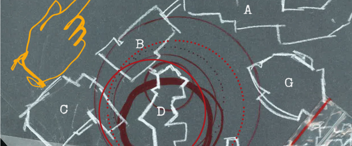
Description: A film canister located on the third floor of building D on the Abbotsford campus. Please bring your own pen to sign the logbook.
Hint: On the third floor of building D, where tired students roam, lies a hidden cache “planted” between “grass” and foam. To find it, you may want to look down towards your feet, and after, you can sign the logbook while taking a seat.


